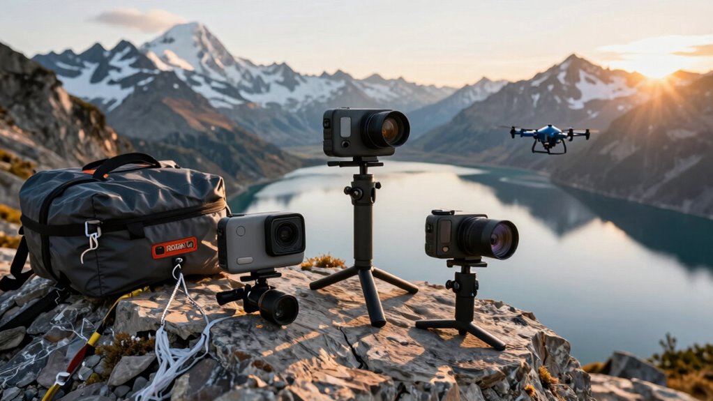
You’ll rely on handheld GPS devices that combine rugged durability, multi-GNSS satellite support, and extended battery life to traverse challenging terrain where smartphones falter. Look for sunlight-readable displays between 2.2 and 3.2 inches, waterproof ratings like IPX7, and battery life spanning 20 to 168 hours depending on your expedition length. Models like the Garmin eTrex 22x and GPSMAP 65 deliver preloaded topographic maps, built-in sensors, and storage capacity up to 32GB. Your best choice depends on specific activities and durability needs—and there’s considerably more to uncover about each option.
| Garmin 010-02256-00 eTrex 22x Rugged Handheld GPS Navigator Black/Navy |  | Best Overall | Primary Use Case: Hiking and cycling navigation | Battery Life: Up to 25 hours (GPS mode, 2 AA batteries) | Display Size: 2.2 inches | VIEW LATEST PRICE | Read Our Analysis |
| Garmin 010-00970-00 eTrex 10 Worldwide Handheld GPS Navigator |  | Best Value | Primary Use Case: General navigation and geocaching | Battery Life: Up to 20 hours (2 AA batteries) | Display Size: 2.2 inches (monochrome) | VIEW LATEST PRICE | Read Our Analysis |
| ZL180 Handheld GPS for Land Surveying & Distance Measuring |  | Best For Surveying | Primary Use Case: Land surveying and distance measuring | Battery Life: Not specified | Display Size: 2.4 inches | VIEW LATEST PRICE | Read Our Analysis |
| Garmin GPSMAP 65 Handheld GPS with Multi-Band Technology |  | Best Multi-Band | Primary Use Case: General outdoor navigation | Battery Life: Not specified | Display Size: 2.6 inches | VIEW LATEST PRICE | Read Our Analysis |
| A6 Handheld GPS Navigator for Hiking Waterproof |  | Best Budget Hiker | Primary Use Case: Hiking navigation | Battery Life: Up to 20 hours (3500mAh rechargeable) | Display Size: 2.4 inches | VIEW LATEST PRICE | Read Our Analysis |
| Handheld GPS Navigator for Hiking Waterproof |  | Most Feature-Rich | Primary Use Case: Hiking, camping, and outdoor activities | Battery Life: Up to 36 hours (4000mAh rechargeable) | Display Size: 3.2 inches | VIEW LATEST PRICE | Read Our Analysis |
| Garmin eTrex SE GPS Handheld Navigator with Multi-GNSS |  | Best Battery Life | Primary Use Case: Hiking and outdoor exploration | Battery Life: Up to 168 hours standard mode, 1,800 hours expedition mode (2 AA batteries) | Display Size: 2.2 inches | VIEW LATEST PRICE | Read Our Analysis |
| Handheld GPS Navigator for Hiking with Topo Map |  | Best Display | Primary Use Case: Hiking and camping | Battery Life: Up to 36 hours (rechargeable, USB-C) | Display Size: 3.2 inches | VIEW LATEST PRICE | Read Our Analysis |
| Garmin inReach Mini 2 Satellite Communicator (010-02602-00) |  | Best Communicator | Primary Use Case: Hiking and emergency communication | Battery Life: Up to 14 days (10-minute tracking mode) | Display Size: Not specified (compact) | VIEW LATEST PRICE | Read Our Analysis |
| Handheld GPS Survey Equipment for Rugged Terrain |  | Professional Grade | Primary Use Case: Land surveying on rugged terrain | Battery Life: Not specified | Display Size: 3.2 inches | VIEW LATEST PRICE | Read Our Analysis |
| ZL190PLUS Handheld GPS Land Surveying Equipment |  | Most Accurate | Primary Use Case: Land surveying | Battery Life: Up to 48 hours (4000mAh rechargeable) | Display Size: 3.2 inches | VIEW LATEST PRICE | Read Our Analysis |
| Garmin eTrex 22x Rugged Handheld GPS Navigator (Renewed) |  | Best Renewed Option | Primary Use Case: Hiking and cycling navigation | Battery Life: Up to 25 hours (GPS mode, 2 AA batteries) | Display Size: 2.2 inches | VIEW LATEST PRICE | Read Our Analysis |
| Garmin eTrex 32x Rugged Handheld GPS Navigator |  | Best Compass Features | Primary Use Case: Hiking and cycling navigation | Battery Life: Up to 25 hours (GPS mode, 2 AA batteries) | Display Size: 2.2 inches | VIEW LATEST PRICE | Read Our Analysis |
| Garmin GPSMAP 65s Handheld GPS with Altimeter |  | Premium Multi-Band | Primary Use Case: Go-anywhere outdoor navigation | Battery Life: Not specified | Display Size: 2.6 inches | VIEW LATEST PRICE | Read Our Analysis |
| Garmin GPSMAP 64sx Handheld GPS with Altimeter |  | Best Connectivity | Primary Use Case: Hiking, cycling, and outdoor adventures | Battery Life: Up to 16 hours (GPS mode) | Display Size: 2.6 inches | VIEW LATEST PRICE | Read Our Analysis |
More Details on Our Top Picks
Garmin 010-02256-00 eTrex 22x Rugged Handheld GPS Navigator Black/Navy
If you’re serious about backcountry exploration, the Garmin eTrex 22x delivers the durability and reliability you need. This rugged navigator features a 2.2″ sunlight-readable display that keeps you oriented in bright conditions. You’ll appreciate the preloaded Topo Active maps with routable roads and trails perfect for hiking and cycling. The device supports GPS and GLONASS satellites, ensuring accurate tracking even in challenging terrain. With 8 GB of internal storage expandable via micro SD card, you’ve got room for detailed maps. Best of all, two AA batteries power this unit for up to 25 hours, keeping you connected throughout extended expeditions.
- Primary Use Case:Hiking and cycling navigation
- Battery Life:Up to 25 hours (GPS mode, 2 AA batteries)
- Display Size:2.2 inches
- Satellite Systems Supported:GPS and GLONASS
- Water Resistance Rating:Not specified
- Internal Memory/Storage:8 GB with micro SD expansion
- Additional Feature:Expandable storage via micro SD
- Additional Feature:Supports dual satellite systems
- Additional Feature:Up to 25 hours battery
Garmin 010-00970-00 eTrex 10 Worldwide Handheld GPS Navigator
The Garmin eTrex 10 delivers rugged, reliable guidance for adventurers who won’t compromise on durability or battery life. You’ll appreciate its waterproof IPX7 design, which shields against splashes and rain during unpredictable escapades. The WAAS-enabled GPS receiver with GLONASS support guarantees fast, accurate positioning even in challenging terrain. You can store waypoints and track elevation data for planning your routes effectively. Running on just two AA batteries, it’ll keep you maneuvering for up to 20 hours—ideal for extended excursions. Its preloaded worldwide basemap and paperless geocaching support make it perfect for treasure hunters and backcountry adventurers alike.
- Primary Use Case:General navigation and geocaching
- Battery Life:Up to 20 hours (2 AA batteries)
- Display Size:2.2 inches (monochrome)
- Satellite Systems Supported:GPS and GLONASS
- Water Resistance Rating:IPX7 waterproof
- Internal Memory/Storage:Preloaded worldwide basemap (capacity not specified)
- Additional Feature:Paperless geocaching support
- Additional Feature:WAAS enabled GPS receiver
- Additional Feature:Elevation tracking for waypoints
ZL180 Handheld GPS for Land Surveying & Distance Measuring
For land surveyors and property assessors who need reliable, portable measurement tools, the ZL180 stands out with its dual-satellite system (GPS + GLONASS) that delivers precise readings across varied terrain. You’ll appreciate its four-in-one measurement functions, allowing you to calculate both straight and curved distances plus two area measurement methods. The compact 180g device fits comfortably in your hand with its ergonomic groove design, while the 2.4-inch backlit LCD screen guarantees visibility in various conditions. With a mere 0.003-acre measurement error and recommendations for areas above 0.16 acres, you’re getting surveying-grade accuracy. However, you’ll need open outdoor spaces—indoor use won’t work due to signal limitations.
- Primary Use Case:Land surveying and distance measuring
- Battery Life:Not specified
- Display Size:2.4 inches
- Satellite Systems Supported:GPS and GLONASS
- Water Resistance Rating:Not specified
- Internal Memory/Storage:Not specified
- Additional Feature:Four-in-one measurement functions
- Additional Feature:0.003 acres area accuracy
- Additional Feature:Humanized groove design grip
Garmin GPSMAP 65 Handheld GPS with Multi-Band Technology
Explorers traversing challenging terrain—steep country, urban canyons, and dense forests—will find Garmin’s multi-band technology essential. You’ll appreciate the 2.6″ sunlight-readable display that keeps you oriented in bright conditions. The expanded GNSS capabilities deliver maximal accuracy where conventional systems falter. You can manage tracks, routes, and waypoints directly on the device, then sync everything with the Garmin Discover app for deeper analysis. The routable TopoActive mapping guides your route finding effectively, while the included Federal public land map covers U.S. terrain thoroughly. This rugged device combines reliability with accessibility for serious thrill-seekers.
- Primary Use Case:General outdoor navigation
- Battery Life:Not specified
- Display Size:2.6 inches
- Satellite Systems Supported:GPS, GLONASS, Galileo, and BeiDou
- Water Resistance Rating:Not specified
- Internal Memory/Storage:8 GB with map downloads
- Additional Feature:Multi-band technology for accuracy
- Additional Feature:Federal public land mapping
- Additional Feature:Garmin Explore app compatible
A6 Handheld GPS Navigator for Hiking Waterproof
If you’re tackling challenging terrain where traditional wayfinding falls short, you’ll appreciate the A6’s rugged waterproof design and multi-GNSS support. This handheld guide combines GPS, Galileo, BeiDou, and QZSS signals for accuracy under five feet, even in difficult conditions. You’ll store up to 1,000 waypoints and record tracks to guide you back to your starting position. The 3500mAh battery powers 20 hours of guidance, while the barometric altimeter and GPS compass provide essential orientation tools. Note that you’ll need clear sky visibility for ideal satellite acquisition, and no maps come preloaded—you’re responsible for providing your own mapping data.
- Primary Use Case:Hiking navigation
- Battery Life:Up to 20 hours (3500mAh rechargeable)
- Display Size:2.4 inches
- Satellite Systems Supported:GPS, Galileo, BeiDou, and QZSS
- Water Resistance Rating:Waterproof (rating not specified)
- Internal Memory/Storage:Not specified
- Additional Feature:Supports four GNSS systems
- Additional Feature:Store up to 1,000 waypoints
- Additional Feature:Barometric altimeter included
Handheld GPS Navigator for Hiking Waterproof
Whether you’re traversing remote trails or trekking through unpredictable weather, a waterproof handheld GPS guide delivers the durability and precision you’ll need when you’re far from civilization. You’ll benefit from multi-GNSS support across GPS, GALILEO, BEIDOU, and QZSS, ensuring accuracy within 5 feet even in challenging terrain. The 3.2″ sunlight-readable display keeps you oriented in bright conditions, while the 4000 mAh battery powers 36 hours of continuous guidance. You can store 20,000 waypoints and 1,000 routes across 16 GB of memory. Built-in sensors—a 3-axis compass and barometric altimeter—provide reliable heading and elevation data. With preloaded USA Topo maps and expandable storage, you’re equipped for any journey.
- Primary Use Case:Hiking, camping, and outdoor activities
- Battery Life:Up to 36 hours (4000mAh rechargeable)
- Display Size:3.2 inches
- Satellite Systems Supported:GPS, Galileo, BeiDou, and QZSS
- Water Resistance Rating:IP66 water-resistant
- Internal Memory/Storage:16 GB preloaded with 32 GB available
- Additional Feature:Stores 20,000 waypoints capacity
- Additional Feature:36 hours battery life
- Additional Feature:USA Topo maps preloaded
Garmin eTrex SE GPS Handheld Navigator with Multi-GNSS
The Garmin eTrex SE stands out as an ideal choice for travelers who demand reliability in remote environments where standard GPS signals falter. You’ll appreciate its multi-GNSS support, which taps into GPS, GLONASS, Galileo, BeiDou, and QZSS for superior tracking in challenging terrain. The 2.2″ high-resolution display remains readable even in bright sunlight, while its IPX7 water-resistant rating handles any weather condition. With up to 168 hours of battery life in standard mode—or an impressive 1,800 hours in expedition mode—you’re covered for extended journeys. Two field-replaceable AA batteries keep you moving, and wireless connectivity with the Garmin Explore app provides software updates, trip planning, and live geocaching cache updates.
- Primary Use Case:Hiking and outdoor exploration
- Battery Life:Up to 168 hours standard mode, 1,800 hours expedition mode (2 AA batteries)
- Display Size:2.2 inches
- Satellite Systems Supported:GPS, GLONASS, Galileo, BeiDou, and QZSS
- Water Resistance Rating:IPX7 water-resistant
- Internal Memory/Storage:Not specified
- Additional Feature:168 hours standard battery mode
- Additional Feature:Multi-GNSS support included
- Additional Feature:Geocaching Live automatic updates
Handheld GPS Navigator for Hiking with Topo Map
Are you searching for a GPS device that’ll keep you on track through remote wilderness without burdening your pack? This handheld navigator delivers compact, lightweight performance with a bright 3.2″ sunlight-readable screen that won’t fail you in glaring conditions. Its multi-GNSS support guarantees pinpoint accuracy within 6 feet, while the built-in 3-axis compass and barometric altimeter guide you reliably even when you’re standing still. You’ll appreciate the 36-hour battery life powered by USB-C charging. The IP66 water-resistant rating protects against harsh weather, and 32 GB storage accommodates extensive map downloads. Preloaded USA Topo maps get you started immediately for hiking and camping excursions.
- Primary Use Case:Hiking and camping
- Battery Life:Up to 36 hours (rechargeable, USB-C)
- Display Size:3.2 inches
- Satellite Systems Supported:GPS, Galileo, BeiDou, and QZSS
- Water Resistance Rating:IP66 water-resistant
- Internal Memory/Storage:32 GB with USA Topo preloaded
- Additional Feature:IP66 water-resistance rating
- Additional Feature:USB-C charging capability
- Additional Feature:USA Topo maps preloaded
Garmin inReach Mini 2 Satellite Communicator (010-02602-00)
For adventurers who need reliable global communication without depending on cellular networks, the Garmin inReach Mini 2 Satellite Communicator (010-02602-00) stands out as an essential tool. You’ll send two-way messages and trigger interactive SOS alerts anywhere worldwide with an active subscription. The device syncs seamlessly with the Garmin Navigate app, letting you plan trips, access topographical maps, and create waypoints. Its TracBack routing feature guides you safely home, while the digital compass provides accurate heading data. Balancing just ounces, this water-resistant communicator delivers up to 14 days of battery life in 10-minute tracking mode, making it indispensable for remote journeys.
- Primary Use Case:Hiking and emergency communication
- Battery Life:Up to 14 days (10-minute tracking mode)
- Display Size:Not specified (compact)
- Satellite Systems Supported:Not specified (satellite communicator)
- Water Resistance Rating:Water-resistant
- Internal Memory/Storage:Not specified
- Additional Feature:Two-way global messaging capability
- Additional Feature:TracBack routing feature
- Additional Feature:14 days battery life
Handheld GPS Survey Equipment for Rugged Terrain
Adventurers who need reliable land measurements across challenging terrain will find handheld GPS survey equipment indispensable, especially when you’re working in remote areas where traditional surveying methods fall short. These devices utilize four satellite systems—GPS, BEIDOU, GLONASS, and QZSS—delivering accuracy within ±0.002 acres. You’ll appreciate the 3.2-inch HD display with anti-glare TFT technology, which performs flawlessly in bright sunlight or low-light conditions. The equipment supports multiple measurement modes customized for farmland, gardens, and pastures, plus distance and slope measurements for versatility. Built rugged with waterproof and dust-proof construction, it’s designed to withstand extreme environments. The portable rubberized case fits comfortably in your hand or pocket. For peak performance, search for satellite signals in open outdoor areas and charge regularly.
- Primary Use Case:Land surveying on rugged terrain
- Battery Life:Not specified
- Display Size:3.2 inches
- Satellite Systems Supported:GPS, BeiDou, GLONASS, and QZSS
- Water Resistance Rating:Waterproof and dust-proof
- Internal Memory/Storage:Not specified
- Additional Feature:±0.002 acres accuracy signal
- Additional Feature:Four satellite positioning systems
- Additional Feature:Anti-glare TFT display screen
ZL190PLUS Handheld GPS Land Surveying Equipment
The ZL190PLUS stands out as an excellent choice if you’re surveying land across varied terrain, thanks to its multi-GNSS support and professional-grade accuracy. You’ll benefit from its 3.2-inch sunlight-readable display and seven measuring models, including area, length, height, and slope measurements. The device delivers impressive precision with area errors under 0.002 acres and distance errors under 5 feet. Its IP65 rating guarantees durability in harsh conditions, while the 4000 mAh battery provides up to 48 hours of continuous operation. Remember, it’s designed strictly for surveying—not routing—and performs best when held horizontally with clear sky visibility for maximum satellite signal reception.
- Primary Use Case:Land surveying
- Battery Life:Up to 48 hours (4000mAh rechargeable)
- Display Size:3.2 inches
- Satellite Systems Supported:GPS, BeiDou, Galileo, GLONASS, NAVIC, and QZSS
- Water Resistance Rating:IP65 waterproof and dust-proof
- Internal Memory/Storage:Storage capacity not specified
- Additional Feature:Seven measuring model options
- Additional Feature:Professional accuracy signals
- Additional Feature:48 hours continuous battery
Garmin eTrex 22x Rugged Handheld GPS Navigator (Renewed)
Serious explorers who won’t compromise on reliability will appreciate what the Garmin eTrex 22x delivers: a compact, durable GPS device built to handle demanding outdoor conditions. You’ll benefit from its 2.2-inch sunlight-readable display, which remains visible whether you’re traversing bright alpine terrain or shaded forests. The preloaded Topo Active maps give you immediate access to routable roads and trails for hiking and cycling. Dual GPS and GLONASS satellite support enhances accuracy in challenging environments where single-system devices struggle. With 8GB of internal storage plus a micro SD card slot, you’ve got ample capacity for extensive map downloads, ensuring you’ll never run short on routing data during extended excursions.
- Primary Use Case:Hiking and cycling navigation
- Battery Life:Up to 25 hours (GPS mode, 2 AA batteries)
- Display Size:2.2 inches
- Satellite Systems Supported:GPS and GLONASS
- Water Resistance Rating:Not specified
- Internal Memory/Storage:8 GB with micro SD expansion
- Additional Feature:Expandable storage via microSD
- Additional Feature:Dual satellite system support
- Additional Feature:Topo Active map preload
Garmin eTrex 32x Rugged Handheld GPS Navigator
If you’re traversing remote terrain where reliability matters most, you’ll appreciate what the Garmin eTrex 32x brings to the table. This rugged guide features a 2.2″ sunlight-readable color display that keeps you oriented in any lighting condition. You’ll benefit from dual GPS and GLONASS satellite support, ensuring accurate tracking even in challenging environments. The preloaded Topo Active maps include routable roads and trails perfect for hiking and cycling, while 8GB of internal memory plus microSD expansion gives you room for detailed mapping. A 3-axis compass and barometric altimeter enhance direction-finding accuracy, and you’ll get up to 25 hours of battery life from standard AA batteries.
- Primary Use Case:Hiking and cycling navigation
- Battery Life:Up to 25 hours (GPS mode, 2 AA batteries)
- Display Size:2.2 inches
- Satellite Systems Supported:GPS and GLONASS
- Water Resistance Rating:Not specified
- Internal Memory/Storage:8 GB with micro SD expansion
- Additional Feature:3-axis compass included
- Additional Feature:Barometric altimeter for navigation
- Additional Feature:MicroSD card expandable storage
Garmin GPSMAP 65s Handheld GPS with Altimeter
Pioneers who need reliable guidance in challenging terrain’ll appreciate the GPSMAP 65s’s expanded GNSS and multi-band technology, which delivers ideal accuracy where standard GPS struggles—steep mountains, urban canyons, and dense forests. You’ll maneuver confidently with its large 2.6″ sunlight-readable color display, integrated 3-axis compass, and barometric altimeter. The device comes preloaded with routable TopoActive mapping and federal public land maps for U.S. exploration. You can sync your tracks, routes, and waypoints with the Garmin Navigate app, allowing you to manage your data seamlessly across devices. Built for serious journeys, the GPSMAP 65s handles demanding terrain effortlessly.
- Primary Use Case:Go-anywhere outdoor navigation
- Battery Life:Not specified
- Display Size:2.6 inches
- Satellite Systems Supported:GPS, GLONASS, Galileo, and multi-band technology
- Water Resistance Rating:Not specified
- Internal Memory/Storage:Not specified
- Additional Feature:Barometric altimeter integrated
- Additional Feature:Multi-band GNSS technology
- Additional Feature:Routable TopoActive map preloaded
Garmin GPSMAP 64sx Handheld GPS with Altimeter
The Garmin GPSMAP 64sx stands out for wanderers who demand reliability in remote terrain. You’ll appreciate its 2.6-inch sunlight-readable display and rugged, water-resistant design built for harsh conditions. The device features multi-GNSS support—GPS, GLONASS, and Galileo—ensuring you maintain accurate positioning even in challenging environments. You get a 3-axis compass and barometric altimeter for precise elevation tracking. Its preloaded TopoActive maps cover the U.S. and Australia with routable roads and trails perfect for hiking and cycling. With up to 16 hours of battery life, Bluetooth and ANT+ connectivity, and a high-sensitivity quad helix antenna, the 64sx delivers the performance explorers need.
- Primary Use Case:Hiking, cycling, and outdoor adventures
- Battery Life:Up to 16 hours (GPS mode)
- Display Size:2.6 inches
- Satellite Systems Supported:GPS, GLONASS, and Galileo
- Water Resistance Rating:Water-resistant with button operation
- Internal Memory/Storage:Not specified
- Additional Feature:Quad helix antenna receiver
- Additional Feature:ANT+ technology available
- Additional Feature:TopoActive maps U.S./Australia
Factors to Consider When Choosing Handheld GPS Devices
When you’re selecting a handheld GPS device, you’ll want to evaluate display size and readability so you can see your route clearly in various lighting conditions. You should also examine battery life and power options, satellite system support, mapping features and storage capacity, and durability ratings to guarantee your device withstands the environments you’ll investigate. These five factors will directly impact how reliably your GPS performs during your journeys.
Display Size And Readability
Because you’ll be maneuvering through varied terrain and changing light conditions, selecting the right display size and readability features matters greatly. You’ll want a screen between 2.2 and 3.2 inches—large enough to view maps clearly without compromising portability. Sunlight-readable displays with anti-glare technology guarantee visibility even in bright outdoor environments, while resolutions like 240 x 320 pixels deliver sharp detail. Multi-color screens help you distinguish map features and waypoints more effectively than monochrome alternatives. Consider devices with physical buttons alongside touchscreen capabilities, particularly if you’ll wear gloves or encounter wet conditions. These combined features optimize your routing experience across diverse adventuring scenarios, keeping you oriented regardless of weather or lighting challenges.
Battery Life And Power Options
Your GPS device’s battery performance directly impacts how long you can roam without returning to civilization. You’ll find two primary power options: standard AA batteries offering up to 168 hours of runtime, and rechargeable lithium-ion batteries lasting 20 to 36 hours. AA batteries let you carry spares for extended trips, while rechargeable models provide convenient USB charging during longer journeys. You should consider that screen brightness, route tracking, and backlighting drain your battery faster. Many devices include power-saving modes that greatly extend battery life during travels. Before purchasing, evaluate your typical trip duration and whether you prefer the convenience of recharging or the flexibility of swapping replaceable batteries. Your choice depends on your escapade style and accessibility to charging options.
Satellite System Support
While standard GPS alone can pinpoint your location, modern handheld devices often support multiple satellite systems—GPS, GLONASS, Galileo, BeiDou, and QZSS—that work together to dramatically improve accuracy and speed. When you’re traversing dense forests or urban canyons, dual GPS and GLONASS support greatly boosts tracking performance by accessing more satellites simultaneously. This multi-GNSS capability delivers faster positioning and accuracy within a few feet, vital for explorers in challenging terrain. Consider devices with multi-band technology too—they employ signals across different frequency bands to minimize interference and maximize precision. By selecting a handheld GPS with extensive satellite system support, you’ll gain reliable positioning in remote or difficult environments where standard GPS alone falls short.
Mapping Features And Storage
Mapping features and storage capacity are critical considerations when selecting a handheld GPS device for your journeys. You’ll find most units come with 8-32 GB of internal memory, which determines how many maps you can store locally. Many devices arrive preloaded with region-specific Topo maps essential for hiking and cycling activities.
If you need additional map coverage, you’re not limited to built-in storage. Most handheld GPS units include micro SD card slots, letting you expand capacity for more detailed maps and waypoints. You should also look for devices showcasing routable roads and trails, which enhance wayfinding precision.
Advanced models integrate online mapping services, giving you access to ever-changing, regularly updated map information. This combination of expandable storage and modern mapping technology guarantees you’ll have reliable wayfinding wherever your explorations take you.
Durability And Weather Resistance
Once you’ve obtained the right maps for your travels, you’ll want a device that can withstand the environments you’ll encounter. Look for waterproof ratings like IPX7 or IP65, which protect against splashes, rain, and dust. Rugged construction is essential—devices engineered to endure drops, shocks, and harsh conditions will serve you reliably. Many models feature rubberized casings and impact-resistant screens that absorb physical stress during exploration.
Consider weather resistance capabilities, including temperature tolerance ranges that allow your device to function in extreme cold or heat. Battery longevity is equally critical; devices offering 20+ hours of operation guarantee consistent guidance without frequent recharging in challenging environments. These durability features combined make your GPS device a dependable companion for any quest.
Navigation Accuracy And Precision
When you’re traversing remote terrain, you’ll want a GPS device that pinpoints your location with precision. Multi-GNSS support—accessing GPS, GLONASS, Galileo, BeiDou, and QZSS simultaneously—dramatically improves accuracy in challenging environments where single-system devices fail.
You’ll benefit from augmentation features like WAAS and HotFix, which reduce positioning errors to within 5 feet or less while accelerating satellite acquisition. Multi-band technology tackles urban canyons and dense forests where traditional signals struggle, providing consistent performance across varied environments.
Built-in sensors enhance your direction finding further. A 3-axis compass provides directional bearings, while a barometric altimeter adjusts your path based on elevation changes. Together, these components create an all-encompassing positioning system that adapts to terrain and environmental obstacles, ensuring reliable navigation wherever your journeys take you.
Intended Use And Functionality
Selecting the right handheld GPS device starts with identifying your primary activities—whether you’re hiking rugged trails, mountain biking, or conducting field surveys—since different devices excel at different tasks. You’ll want to examine what features matter most for your specific pursuits.
Consider satellite support systems carefully. Devices supporting multiple GNSS technologies like GPS, GLONASS, Galileo, and BeiDou deliver superior accuracy and reliability when you’re traversing dense forests or mountainous terrain where single-system devices struggle.
Don’t overlook mapping capabilities either. You’ll benefit from preloaded topographic maps and the ability to download custom maps for unfamiliar regions. Battery life also warrants attention—extending from 20 to 36 hours depending on the model—ensuring your device lasts through extended expeditions without failing you mid-journey.

Leave a Reply